Historical Marker – Curtis Headquarters
Tour Stop

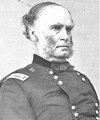
Directions: There is a historical marker [ Waypoint = N36 26.437 W94 01.905 ] about the location of the headquarters for Union Brigadier General Samuel R. Curtis during the Battle of Pea Ridge.
- Leave the parking area and head west for 0.6 miles on Sugar Creek Road to return to US Hwy 62.
- After 0.6 miles, turn right (east) onto US Highway 62.
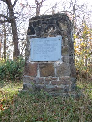
- After approximately 2.4 miles, you should see a Historical Marker [ Waypoint = N36 26.437 W94 01.905 ] made out of stone masonry with a metal plaque on the right (south) side of the highway.

“U. S. Army Headquarters 1862”
“This site was the camp-ground for commanding officers and headquarters of U. S. Army for Battle of Pea Ridge. Here councils of war were held. Camp for 10,500 U. S. Army soldiers located 1 ½ miles south. Depot of supplies 1 mile north of this site.”
“Marked by Winton Spring Farm 1935.”
Back: Federal Entrenchments at Little Sugar Creek
Next: Pea Ridge National Military Park Visitor Center
