Navigation
- Home
- Multimedia
- Programs
- Civil War Biographies
- Bleeding Kansas (1854-1860)
- St. Louis in 1861
- The Battle of Boonville
- The Battle of Carthage
- The Battle of Wilson's Creek
- The Battle of Lexington (1861)
- The Battle of Pea Ridge
- Quantrill's Lawrence Raid (1863)
- The Battle of Pilot Knob
- Independence Historical Markers
- The Battle of Byram's Ford
- The Battle of Westport
- Price's Retreat From Westport
- Time Lines
- BBB Walking Tour
- Brush Creek Walking Tour
- BOW Driving Tour Book
- Updates/Errata
- Maps
- Overview
- Stop 1
- Stop 2
- Stop 3
- Stop 4
- Stop 5
- Stop 6
- Stop 7
- Stop 8
- Stop 9
- Stop 10
- Stop 11
- Stop 12
- Stop 13
- Stop 14
- Stop 15
- Stop 16
- Stop 17
- Stop 18
- Stop 19
- Stop 20
- Stop 21
- Stop 22
- Stop 23
- Stop 24
- Stop 25
- Stop 26
- Stop 27
- Stop 28
- Stop 29
- Stop 30
- Stop 31
- Stop 32
- Stop 33
- Stop 34
- Stop 35
- Stop 36
- Stop 37
- Stop 38
- Stop 39
- Stop 40
- Stop 41
- Stop 42
- Stop 43
- Stop 44
- Stop 45
- Stop 46
- Stop 47
- Stop 48
- Stop 49
- Stop 50
- Stop 51
- Stop 52
- Stop 53
- Stop 54
- Stop 55
- Stop 56
- Stop 57
- Stop 58
- Stop 59
- Stop 60
- Stop 61
- Stop 62
- Stop 63
- Stop 64
Stop 65
News
May 13, 2010
Category: American Civil War
Posted by: TheMuse
Are you confused about what was the offical national flag of the Confederate States of America? Here's a link to a YouTube video called, Vexillology and the Confederate Flag, featuring Dr. Thomas G. Clemens of Hagerstown Community College.
[More]
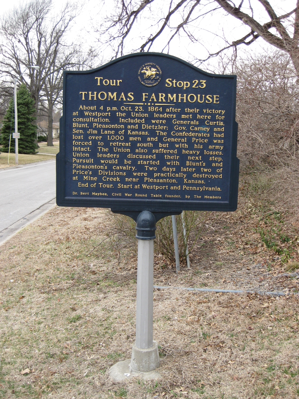
Stop 65: Thomas Farmhouse
[Waypoint 38.953478 -94.596144]
The last tour stop is a historical marker located near the intersection of Wornall Road and W. 96th Terrace.
Back: Stop 64—New Santa Fe