Tour Stop 5 [ Waypoint = N39 02.112 W94 35.664 ]
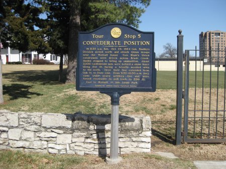
"At 8:30 A.M. Sunday, October 23, 1864, General Shelby's Division moved north and struck Union troops near the Wornall House. General Blunt's Union cavalrymen were driven across Brush Creek. Shelby stopped to bring up ammunition. About 3,000 men were behind a stone fence along 51st Street facing a heavily wooded area to the north. Here their line extended from Oak Street to State Line. From 9:30 - 10:30 A.M. They came under heavy artillery fire and were forced eventually to pull back to 55th Street."
| Map |
Directions to Stop #5: Tour Stop 5 is located about 200 yards west of Wornall Road on 51st Street. Leaving Tour Stop 4, drive east on 55th Street for about one quarter of a mile and turn left (north) on Summit Street. After about 0.4 miles, Summit turns into 52nd Street which continues on for about 0.15 miles to intersect with 51st Street. Park in the parking lot on the right (Loose Park) before you get to 51st Street. The marker is on the north side of 51st Street at the end of the soccer field. This tour stop is located in Kansas City, Missouri 64112.
 Description: When they began their attack at dawn, the two Confederate divisions had been able to push the Union forces back to the north side of Brush Creek. However, Shelby could not press further for ammunition had run low. It took an hour to replenish his Confederate troops. He had lost the advantage. Shelby and Fagan now waited on the heights south of Brush Creek near where you are standing. Throughout the rest of the mornings, the Federals tried several attacks against this Confederate position only to be forced back to Brush Creek. This was the position that Curtis was able to outflank when George Thoman led them around through the wooded defile to the west.
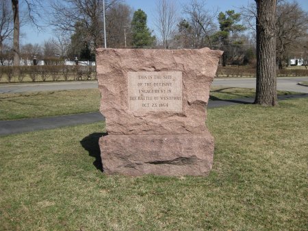
Optional Tour Stop: Battle of Westport Red Granite Marker
| Waypoint = N39 02.072 W94 35.716 |
Directions: Immediately to the south of where you parked for Tour Stop 5 is a large Red Granite Marker that commemorates the Battle of Westport.

 Description: When they began their attack at dawn, the two Confederate divisions had been able to push the Union forces back to the north side of Brush Creek. However, Shelby could not press further for ammunition had run low. It took an hour to replenish his Confederate troops. He had lost the advantage. Shelby and Fagan now waited on the heights south of Brush Creek near where you are standing. Throughout the rest of the mornings, the Federals tried several attacks against this Confederate position only to be forced back to Brush Creek. This was the position that Curtis was able to outflank when George Thoman led them around through the wooded defile to the west.