Tour Stop
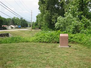
 Directions: The Knob Creek Historical Marker [ Waypoint = N37 37.038 W90 38.429 ] is located near the corner of Main Street (Old Highway 21) and State Highway 21 in Pilot Knob, Missouri 63663.
- From the Confederate Assault stop, turn around to backtrack down Industrial Drive until you get to the intersection with Main Street (Old Highway 21).
- Turn left onto Main Street (Old Highway 21).
- After you cross over Knob Creek but before you get to State Highway 21, turn left into the parking area for the bank. There is a kiosk with tourist information.
- The historical marker is located just north of the parking area near the creek.
Description: The text on the historical marker:
Battle of Pilot Knob
Knob Creek
September 27, 1864
2:00 P.M. – 5:30 P.M.
The two branches of Knob Creek, a tributary of Stouts Creek, enclosed Ft. Davidson on three sides. Cabell's brigade charged the fort three times from its position behind the creek in the center of the rebel line. Most of Clark's Brigade on the left of the rebel line and all of Slemons and McCray's Brigades on the right took cover in Knob Creek during the first charge and were not factors in the rest of the battle.
The Confederates launched their first attack from Knob Creek. After the first attack failed, they fell back to the relative safety of Knob Creek. Sergeant-Major John H. Delano, Forty-seventh Missouri Infantry, remembered how the Confederates used the banks of Knob Creek for cover. [80]
"The charge was soon over. The enemy had to fall back, leaving the ground covered with their men. They came up out of the creek bed and fell back into it again. From there sharpshooters were continually picking off our artillerymen. Judging by appearances, we supposed that there were only a few here and there along the bed of the creek who were doing this mischief; and Captain Mace, of Co. G, filed down the south rifle-pit with his company. About half-way down he and his men jumped out of the pit to charge. They had hardly started when there was a volley along the whole length of the creek bed, and Captain Mace and his followers came rushing back. Fortunately none were hurt."
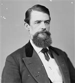
 Brigadier-General William Cabell wrote in his official report about how Knob Creek was used for its natural cover. [81]
"I moved to the charge on Marmaduke's right, as directed. My men had no shelter, but were in open ground for 1200 yards. Marmaduke's men took shelter in a creek with high banks."
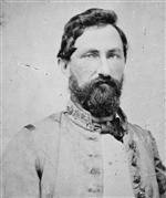
 Confederate Brigadier-General John B. Clark, Jr. was in command of Marmaduke's Brigade in Marmaduke's Division. He described the use of Knob Creek for its natural cover. [82]
"They recoiled before the terrible fire that was continually poured into their ranks, falling back from 75 to 100 yards from the fort under cover of a small natural embankment, and remained until after night-fall, when they were quietly withdrawn to an encampment one mile distant."
 Directions: The Knob Creek Historical Marker [ Waypoint = N37 37.038 W90 38.429 ] is located near the corner of Main Street (Old Highway 21) and State Highway 21 in Pilot Knob, Missouri 63663.
 Brigadier-General William Cabell wrote in his official report about how Knob Creek was used for its natural cover. [81]
 Confederate Brigadier-General John B. Clark, Jr. was in command of Marmaduke's Brigade in Marmaduke's Division. He described the use of Knob Creek for its natural cover. [82]