Tour Stop
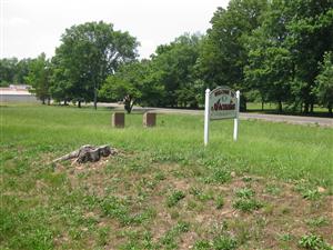
 Directions: There are two historical markers next to one another in Arcadia. They are located near the Welcome To Arcadia sign near the intersection of Highway 72 and Thompson Road in Arcadia, Missouri
- If you are east of the Highway 72 Bridge over Stout's Creek, you should continue driving east until you can find a safe place to turn your car around. If you are leaving from the historical marker, just return to Highway 72 and turn right (east) heading back to Arcadia.
- From the Highway 72 Bridge over Stout's Creek, go about 2 miles on Highway 72 until you see the Welcome To Arcadia sign on the left.
- From the historical marker, go about 1.6 miles on Highway 72 until you see the Welcome To Arcadia sign on the left.
- Turn left onto Thompson Road and find a place to park on the side of the road.
- The historical markers are located just behind the Welcome To Arcadia sign.
Description: I will wait for the next tour stop (Russellville – Federal Pickets) to discuss the skirmishing that occurred here on September 26, 1864.
Historical Marker: The Arcadia Valley (South)

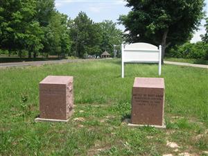
This marker [ Waypoint = N37 35.325 W90 37.086 ] is the one closest to Highway 72. The text on the historical marker:
Battle of Pilot Knob
The Arcadia Valley
The three towns of Arcadia, Ironton, and Pilot Knob are located in the Arcadia Valley. The valley's iron mining industry helped spur population growth and led the St. Louis & Iron Mt. Railroad to extend its tracks to Pilot Knob in 1858. The strategic nature of the railroad terminus and supply depot then situated in Pilot Knob explains the presence of Union Forces in the Valley during the Civil War and why the Battle of Pilot Knob was fought.
Historical Marker: Russellville Junction
This marker [ Waypoint = N37 35.323 W90 37.087 ] is the one closest to Thompson Road. The text on the historical marker:
Battle of Pilot Knob
Russellville Junction
September 26, 1864
1:00 P.M. -----2:30 P.M.
Selmons' Brigade riding in advance of the rebel army was first spotted at 1 P.M., by pickets here at the Russellville Junction. After the pickets had sounded the alarm, a cavalry rode here to verify the pickets report. Despite much shooting there were no casualties on either side.
This phase of the conflict ended at 2:30 P.M. when the Union Cavalry fled leaving the road to Ironton open to the Confederate advance.
 Directions: There are two historical markers next to one another in Arcadia. They are located near the Welcome To Arcadia sign near the intersection of Highway 72 and Thompson Road in Arcadia, Missouri
