Tour Stop 3.2 [ Waypoint = N38 08.710 W94 43.323 ]
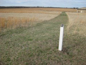
Directions to Stop #3.2: Trail Marker 2 is located just south and west of Trail Marker 1. Just follow the trail heading south to the next marker. This tour stop is located near Pleasanton, Kansas 66075.
 Description: You are standing on Fort Scott Road in between the opposing forces. Take a moment to think about the troops that were just about ready to start fighting. It's about 11:00 A.M. on the morning of October 25, 1864. Marmaduke had originally planned to get across the stream and set up his rear guard defense on the south side of Mine Creek. He felt he would be able hold off the Federals from that position. But just before 11:00 A.M., Marmaduke had found that the Mine Creek crossing was blocked. Because of the heavy rains the creek was a raging torrent. The two available fords were backed up with over 100 wagons still trying to get across. To further complicate matters, a wagon had overturned and was now blocking the ford.
Marmaduke realized he would have to set up his defense line on the north side of the creek. He deployed Clark's and Freeman's Brigades as a rear guard. The Confederate line extended about 800 yards and contained about 4,825 men. At this point Philips' Brigade came across a ridge about 1,000 yards north of the Confederates. As the Federals came into view, Marmaduke requested assistance from Fagan' Division. Fagan had gotten all of his division south of Mine Creek except for Cabell's Brigade. After Marmaduke's request, Cabell's Brigade immediately deployed into the line of battle. Cabell was about to order a charge when Benteen's Brigade joined Philips to the north.
Fagan brought the rest of his division across to the north side of the creek and extended the Confederate line west. Marmaduke felt he was now confronted by an overwhelming force and sent back a request to Price for reinforcements. Neither Marmaduke nor Fagan deployed any of their troops as a reserve force.
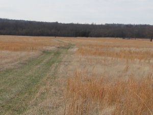
 Look to the south. Off in the distance there are two red markers. The marker directly south of you marks the initial Confederate line of battle across the Fort Scott Road. There is another red marker to the southeast (it may be difficult to pick out from where you are standing) that marks the right flank of the Confederate line. The Confederate line of battle extended about three quarters of a mile to the west from this marker.
- Brigadier General John B. Clark Jr.'s Brigade (about 1,450 men) from Marmaduke's Division was on the Confederate right flank. His troops extended from the left red marker to just east of the red marker to your immediate south. Hynson's Texas Battery (two 10 pound Parrotts) was deployed on the right flank (near the red marker to your left).
- Colonel Thomas R. Freeman's Brigade (about 1,000 men) from Marmaduke's Division was deployed on Clark's left on the Fort Scott Road. Harris' Battery (two 10 pound Parrotts and one six pounder) was deployed at the center of the line near where the center red marker stands. You are standing just to the north of their position.
- Brigadier General William L. Cabell's Brigade (about 2,100 men) from Fagan's Division was deployed just left of center and extended to the little hillock about 100 yards north of a north bend in Mine Creek. Blocher's Arkansas Battery (two guns) was on the Confederate left flank.
- Colonel W. F. Slemmons' Brigade (about 800 men) from Fagan's Division was deployed to Cabell's left.
- Colonel Archibald S. Dobbin's Brigade (about 500 men) from Fagan's Division was deployed with Slemmons on the Confederate Left flank
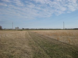
 Now turn and look to the north at the Federal position. Up on the hill by the red marker was the Federal line of battle.
- Colonel John F. Philips' First Cavalry Brigade (about 1,400 well-armed men) from Pleasonton's Division arrived first and formed to the left of the red marker to the north.
- Philips was soon joined by Lieutenant Colonel Frederick W. Benteen's Fourth Brigade (about 1,100 well-armed men) from Pleasonton's Division who formed to the right of the red marker to the north.
Philips immediately saw that the Federals were outnumbered. They were facing more than 6,000 Confederates along with their artillery. He sent back a request to Pleasonton for reinforcements. Philips' Brigade came under Confederate artillery fire and became pinned down. Philips' artillery returned this fire.
 Description: You are standing on Fort Scott Road in between the opposing forces. Take a moment to think about the troops that were just about ready to start fighting. It's about 11:00 A.M. on the morning of October 25, 1864. Marmaduke had originally planned to get across the stream and set up his rear guard defense on the south side of Mine Creek. He felt he would be able hold off the Federals from that position. But just before 11:00 A.M., Marmaduke had found that the Mine Creek crossing was blocked. Because of the heavy rains the creek was a raging torrent. The two available fords were backed up with over 100 wagons still trying to get across. To further complicate matters, a wagon had overturned and was now blocking the ford.
 Look to the south. Off in the distance there are two red markers. The marker directly south of you marks the initial Confederate line of battle across the Fort Scott Road. There is another red marker to the southeast (it may be difficult to pick out from where you are standing) that marks the right flank of the Confederate line. The Confederate line of battle extended about three quarters of a mile to the west from this marker.
 Now turn and look to the north at the Federal position. Up on the hill by the red marker was the Federal line of battle.